
Beyond the Pin Drop: What "Location Accuracy" Really Means in Urban Canyons & Rural Areas
Why is your location pin wrong in a city or the woods? Learn how GPS, Wi-Fi, and cell towers work (and fail) in different environments for family tracking.


You open your family map app and see your child's location pin. In a wide-open park, it's a precise dot. In downtown Manhattan, it's a blurry circle a block wide. Out on a rural hiking trail, it might not update at all.
This isn't a bug in your app. It's physics. As a product manager, I spend countless hours engineering around these real-world limitations. "Location accuracy" isn't a single number; it's a fluid concept that changes with your environment. Understanding why empowers you to use these tools smarter and set realistic expectations.
Let's move beyond the frustrating pin drop and explore what's really happening with the signals in urban canyons, suburban neighborhoods, and wide-open rural spaces.
The Signal Struggle: Why Environment is Everything
Your phone's location is a best-guess estimate based on available signals. Each environment presents unique challenges.
Urban Canyons: The Multipath Problem
In a city of skyscrapers, GPS signals don't travel in a clean line from satellite to phone. They bounce off glass and steel buildings in a phenomenon called multipath propagation.
- Effect: Your phone receives the same signal multiple times, from different paths, at slightly different times. This confuses the calculation, causing the location to "jump" or settle within a large area of uncertainty (that big circle on your map).
- The Workaround: Apps lean heavily on Wi-Fi Positioning here. The dense concentration of Wi-Fi routers in cities provides a strong web of reference points, often improving accuracy once you're near buildings.
- Effect: Location relies entirely on the fuzzy estimate from nearby cell towers and, if enabled, the Bluetooth beacons sometimes installed in large venues.
- The Reality: Indoor location is often "good enough" to know you're in a specific building, but can't tell which store in the mall you're in. Trusting a precise indoor pin is a mistake.
- A small, tight circle (e.g., 50 feet): High confidence. Likely a clear GPS fix combined with strong Wi-Fi or cell data.
- A large, wide circle (e.g., 300 feet): Low confidence. The phone is using weaker signals, like cell tower triangulation in a city or rural area.
- A pulsating or jumping pin: The phone is actively recalculating as signals come and go. Very common in moving vehicles or dense urban areas.
Indoor Spaces: The Blackout Zone
GPS signals cannot penetrate most roofs and walls. Inside a mall, school, or home, GPS effectively turns off.
Decoding the Map: What the Blue Circle Actually Tells You
That circle around a location pin isn't a mistake—it's crucial information. It's the radius of uncertainty.
Strategic Use: Choosing the Right Tool for the Terrain
Knowing these limits helps you pick the right tool and use it correctly.
Actionable Tips for Reliable Awareness
- Trust Geofences Over Pins: In challenging areas, set a geofence around the entire destination area (e.g., "Central Park" or "Miller's Grocery Store"). An "Arrived" alert is more reliable than staring at a bouncing pin.
- Use Check-Ins as Data Points: Have family members send a manual check-in ("I'm at the library entrance") when arriving at a tricky location. This gives you a confirmed anchor point.
- Understand "Last Known Location": If a device goes offline, the map will show where it last reported from. This is a feature, not a failure—it's the best data available and can be critical.
- For Critical Rural Safety: Invest in a standalone device. A satellite communicator is essential for activities where cell service is guaranteed to be absent.
Conclusion: Embracing Intelligent Uncertainty
Chasing a perfectly accurate, real-time pin in every environment will lead to frustration. The power of family location tools lies in pattern awareness and event-based alerts, not constant, pinpoint surveillance.
By understanding the science behind the signal, you can interpret the map like a pro, set alerts that actually work, and use technology as a sensible aid to your family's safety—wherever your adventures take you.
About the Creator
Olivia Martinez
Lead Product Manager, Author at Number Tracker
https://numbertracker360.com
Keep reading
More stories from Olivia Martinez and writers in 01 and other communities.
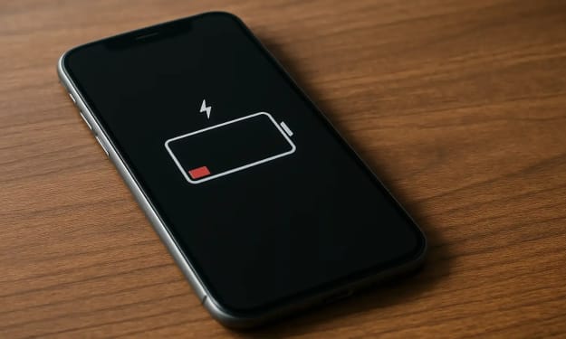
The Silent Guardian: How Background Location Tracking Works Without Draining Your Battery
We’ve all been there. You’re using a family location app for peace of mind, but by midday, your phone’s battery icon is glaring red. It feels like a trade-off: either know your loved ones are safe, or have a phone that actually lasts.
By Olivia Martinez3 days ago in 01
Daniel Raphael Dreamporting Reviews: A Deep Dive Into Conscious Dream Navigation
Imagine having the ability to consciously navigate your dreams—not just remember them, but actually steer them toward your deepest desires. That's the promise behind Dreamporting, a consciousness technique that's gaining serious attention in personal development circles. But what exactly happens when you dive into this practice, and do the Daniel Raphael Dreamporting reviews match the bold claims?
By Jeffrey D. Gross MD8 days ago in 01
How to Maintain an App in 2026 Without Bleeding Money
I reckon most people think hitting "publish" on the App Store is the end of the road. It isn't. Not even close. If you want to know how to maintain an app in 2026, you've got to realize it is a perpetual cycle of fixing things that weren't even broken yesterday.
By Samantha Blake7 days ago in 01


Comments
There are no comments for this story
Be the first to respond and start the conversation.